How to Make an As-Built Map of Your Irrigation System
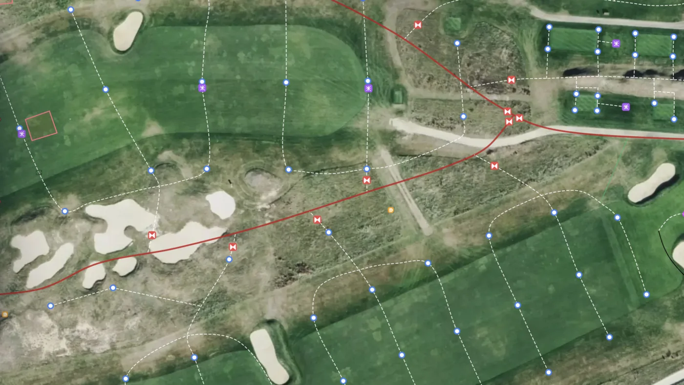
An as-built shows your irrigation system as it was actually installed, not as it was designed. Most courses either never received one or are working from a version old enough that nobody fully trusts it. We covered why that happens in the as-built map problem. This guide covers the fix: how to make an irrigation as-built with your own crew, and how to keep it accurate as the system changes.
Start with the drawings you already have
Dig up whatever records exist before anyone walks the course. Design drawings, contractor sketches, old as-builts, and marked-up plans are all useful, even when they are wrong in places. They tell you where to look.
If the best record you have is a paper or PDF plan, Turfile can georeference it for you and add it to your map as a layer. The old drawing then sits under the live map, and your crew confirms or corrects it in the field instead of starting from a blank page.
Decide how accurate it needs to be
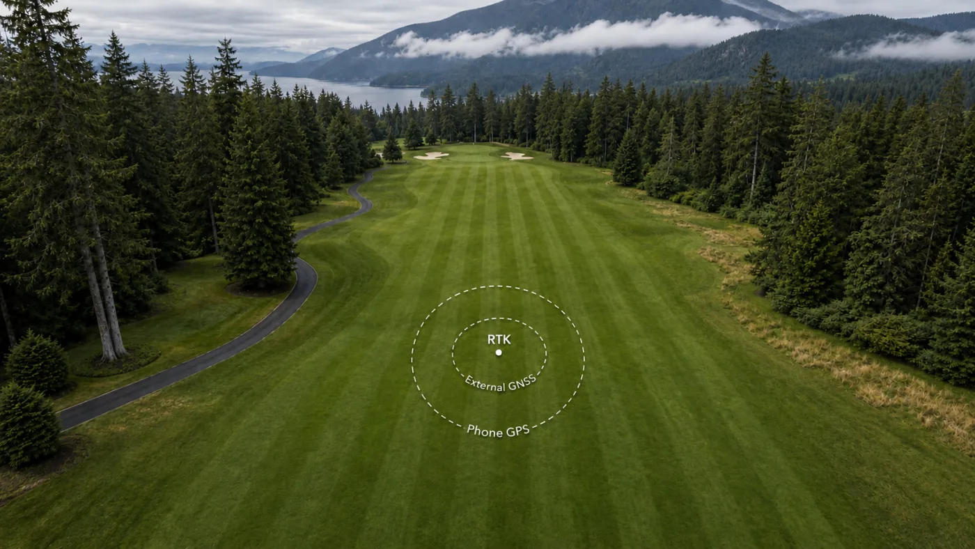
Accuracy is a budget decision. There are roughly three levels: phone GPS at 1 to 5 meters, an external GNSS receiver at about a meter down to 30 centimeters, and an RTK survey at 1 to 3 centimeters. We wrote a full guide to choosing between them.
The short version: if you are mid-renovation with trenches open, document at survey grade while you can. If you are mapping an established system so your crew can find things, phone accuracy does the job, and you can tighten the map later.
Map the visible parts first
Heads and valve boxes sit at the surface, so a crew member can walk a hole and map them in one pass. Working hole by hole keeps the project measurable: eighteen small jobs instead of one big one.
Then add what is known about the mains and laterals. Long-serving crew members usually know more of the routing than any drawing does. Walk the course with them and map while they point. Where a run is uncertain, map it anyway and mark it as suspected, then correct it whenever the ground is open.
Controllers, satellites, quick couplers, and isolation valves round out the picture. Wire runs are worth mapping carefully, because a future excavation that cuts one is an expensive mistake.
Record the details on each asset
The detail on each asset is what separates an as-built from a simple map. Where you know them, record:
- Head make, model, and nozzle
- Valve size and type
- Pipe size and material on each run
- Depth, where you know it
- Photos, especially of open trenches before backfill
Photograph every open trench before it closes. That photo, pinned to the map at that location, answers questions for decades.
Keep it current
The reason most as-builts stop being trusted is that the system keeps changing after the drawing is delivered. Heads get moved, laterals get added, repairs reroute pipe. When your own crew maintains the map, each change takes a minute to record: update the asset, attach a photo, log the repair with the date.
After a season of this, the as-built matches the ground, and every asset carries its own service history. That is a stronger record than any one-time survey deliverable, because it is still true a year later.
Own the data
Whether the data starts on your phone or comes from an RTK crew, keep it in a format you own. Turfile imports shapefiles, GeoPackage, KML, and GeoJSON, and you can export your data at any time, so the as-built is never locked inside someone else’s system. The irrigation mapping docs cover the workflow from first asset to full export.
Frequently asked questions
Do we need GPS hardware to make an as-built? No. Phone mapping covers everyday use, and points are placed by tapping the map against the imagery rather than relying on the device’s location. Add an external GNSS receiver if you want tighter positions, or bring in an RTK crew and import their data.
How long does it take? Heads and valve boxes across a full course are a few days of walking. Mains and laterals take longer, because much of the routing gets confirmed as the ground opens for repairs. Map what you can see first and let the buried parts fill in over time.
What if nobody knows where the pipes run? Map the runs you can infer from the head layout and known valves, mark them as suspected, and confirm them during repairs. Irrigation mapping in Turfile is built around this kind of gradual, crew-driven record.