GPS Irrigation Mapping: Phone, GNSS Receiver, or RTK Survey?
Every conversation about GPS irrigation mapping eventually lands on the same question: how accurate does it need to be?
There are roughly three tiers. They differ a lot in cost, and the right one depends on where your course is at and what you want to spend. This guide covers what each tier gives you, what it costs, and how to choose.
Tier 1: Approximate (1 to 5 meters)
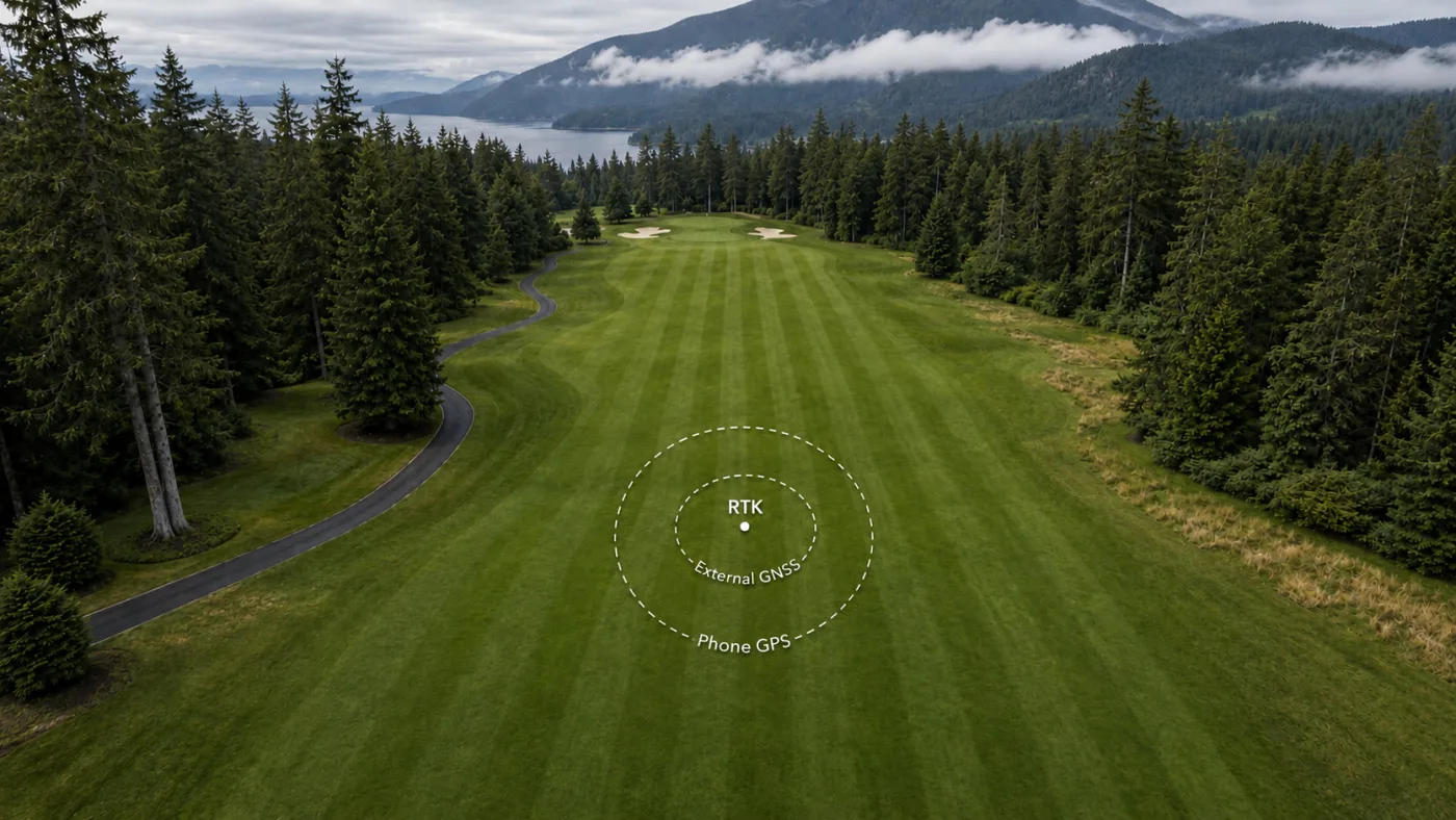
Phone GPS is accurate to about 1 to 5 meters in open sky. It is the same positioning that powers Apple and Google Maps, so if you have ever watched your blue dot sit on the wrong side of the street, you already understand its limitations.
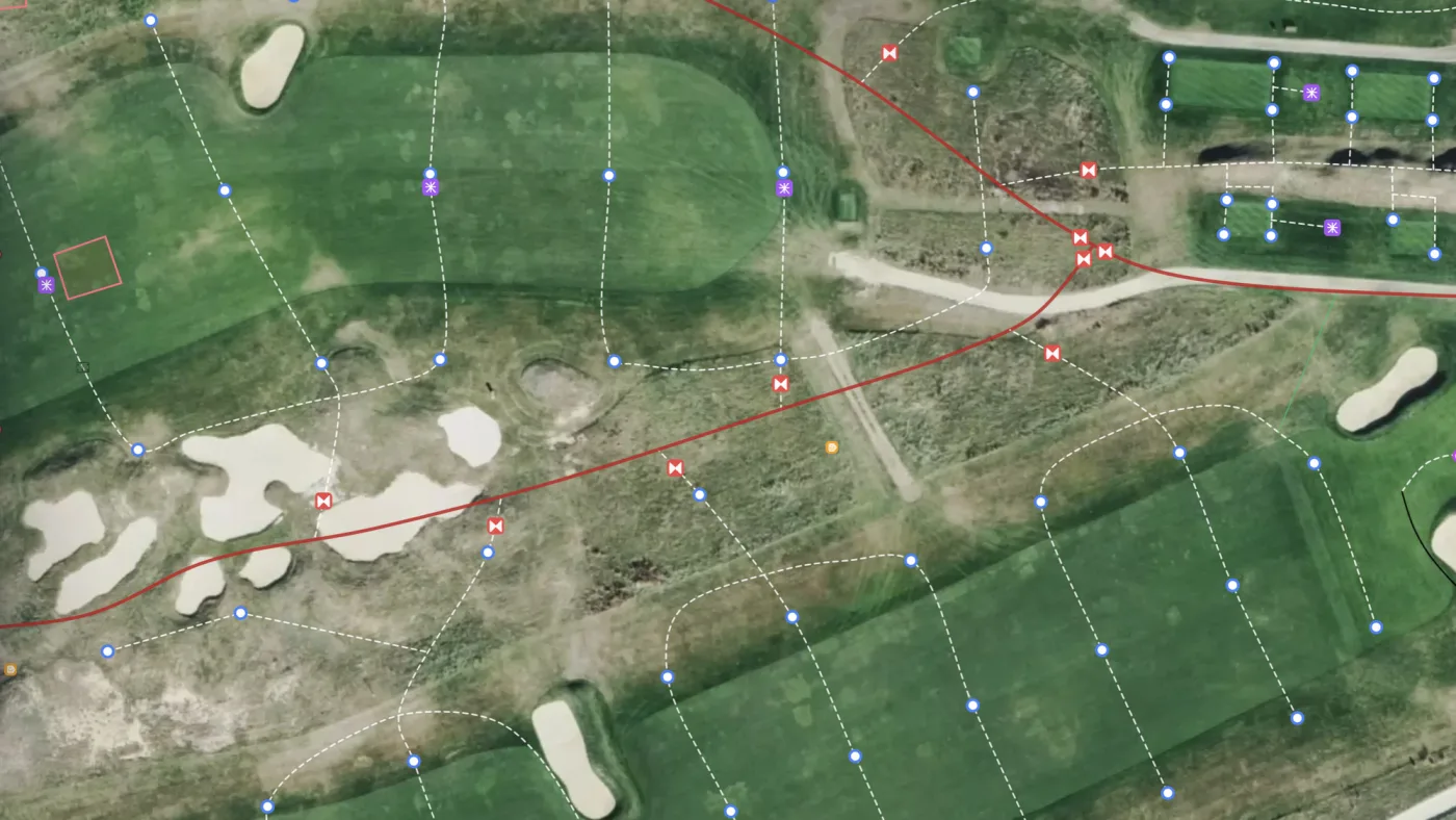
This is why Turfile lets you tap the map to place objects instead of relying only on the device’s location. Your position gets you close, and features you can see on the imagery, like cut lines, bunker edges, and cart paths, let you place each point in the right spot.
Best for: everyday mapping, record keeping, and finding the general area of an asset.
Tier 2: High accuracy (30 centimeters to 1 meter)
An external GNSS receiver without RTK corrections typically brings positions to about a meter, and higher-end units reach around 30 centimeters. There are two ways to use one. Receivers like a Bad Elf pair with your phone over Bluetooth and feed it the better position directly, so your crew keeps mapping in the Turfile app exactly as before. Standalone units collect the data on their own, and you import that data into Turfile afterward. Either way it is a one-time hardware cost, roughly a few hundred to a couple thousand dollars depending on the unit.
Best for: reliable field navigation and digging in the right spot every time.
Tier 3: Survey grade (1 to 3 centimeters)
An RTK GNSS receiver working with live corrections locates points to within 1 to 3 centimeters. It is what professional mapping services and survey crews use. An RTK survey is a project: a crew on site, a real invoice, and a deliverable. If you commission one, that deliverable should be data you own, shapefiles or another GIS format, not just a PDF.
Best for: precise as-builts, construction, trenching, and machine guidance.
Match the method to your stage and your budget
If you are breaking ground on a new system or in the middle of a major renovation, get an RTK survey. The trenches are open, you are already investing serious money in the ground, and this is the one chance to document everything at survey grade before it gets buried. And if a professional high-accuracy survey is in the budget and you are in the market for one, it is a no-brainer.
If you simply want to get started, your phone is all you need. Send your longest-serving crew member out to map the valves they know before that knowledge retires. You spend nothing on hardware or services, and you can always tighten the map up later with an external receiver or imported survey data.
Turfile supports whichever route fits your club. Phone mapping is built into the app. Phone-paired GNSS receivers feed the app directly, and data collected on a standalone receiver imports straight into Turfile as shapefiles, GeoPackage, KML, or GeoJSON with its accuracy preserved, RTK included. Old as-builts on paper or PDF can be georeferenced and added as layers to map against.
A common misunderstanding about accuracy
A lot of courses are sold on the idea that 2 centimeter or sub-centimeter mapping will, on its own, change how well they can manage their system. Before paying for that level of precision, ask three questions:
- Why is higher accuracy better for your operation, specifically?
- Do you have a high-accuracy receiver your crew will use in the field after the survey is complete?
- Will contractors doing future work on the property be using high-accuracy receivers?
If the answer to the last two is no, the precision has no way to get used. Centimeter data is only centimeter valuable when you have centimeter equipment to view it. A crew pulling up the map on a phone is working at the phone’s 1 to 5 meters that day, regardless of what the survey cost.
The base map is worth knowing about here too: survey-grade data placed over standard satellite imagery can sit visibly off the ground features, because the imagery was not captured to the same accuracy. If you want that data to line up perfectly on screen, it needs an equally accurate base map underneath it, like an RTK drone survey.
Survey grade accuracy is a good investment when you have the equipment and the use cases to take advantage of it. If you do not, a phone-built map covers day-to-day management at a fraction of the cost. Whichever tier fits, the map stays current because your own crew maintains it, and nobody searches for the same valve twice.
Frequently asked questions
Is phone GPS really accurate enough to find a buried valve? Combined with the map, yes. Points are placed against the imagery rather than blind coordinates, so the pin sits on the feature you lined it up with. Getting back to it, the map gets you within a few paces, the attached photo shows you the exact spot, and the asset’s record tells you what you’re looking for.
Should we hire a GIS mapping service instead of doing it ourselves? A mapping service produces an accurate snapshot, and if you commission one, insist on receiving the GIS data itself. The tradeoff is that a snapshot cannot stay current. Most courses get more long-term value from a map their own crew builds and maintains.
What should we map first? Whatever costs you the most time to find: usually valves and heads in problem areas, then mains, then everything else hole by hole. The irrigation mapping guide covers the workflow from first asset to full export.