
Area measurement and prescription mapping.
Every surface, measured. Map every area your golf course maintains and get square footage you can plan against.
Stop planning from estimates.
Product rates, sand orders, and budget lines all start from one number: how much area you actually maintain. Most courses run on estimates that vary by who you ask, or pay a measurement service or GIS consultant to pin the number down once.
Turfile turns your golf course into a measured property your own team keeps current. Every green, fairway, tee, and rough area gets mapped and totalled, and the same areas become prescription maps your sprayer can follow.
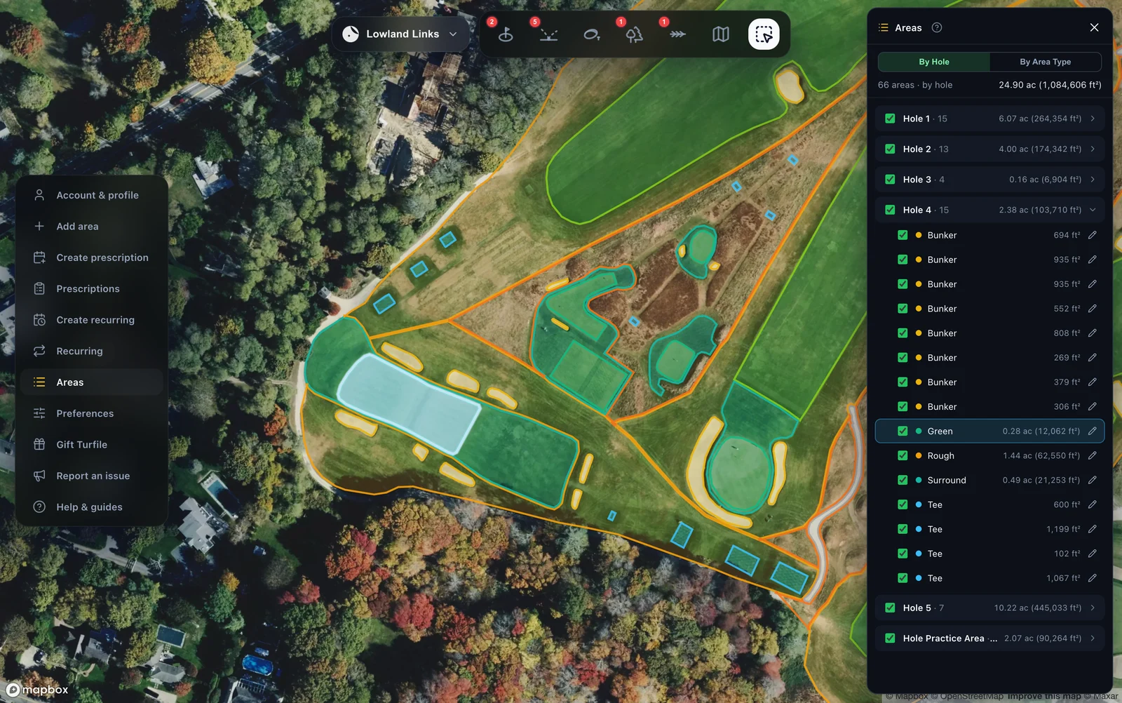
Draw it, or let Vision trace it.
Outline each area by hand, or click once and let Turfile Vision trace the surface for you. Tag it by hole, set the area type, and pick your colours, so the map reads the way your crew talks about the course.
One ledger, every area.
Every mapped area lands in a single ledger, grouped by hole, with square footage totals by area type. You get one reliable number for how much green, fairway, and rough you actually maintain, and you can order product and sand against it.
When a boundary changes, your team updates the map and the totals update with it. There is no re-measuring the property.
From estimate to measurement.
Estimates and consultants
- Square footage that varies by who you ask
- Pay a consultant to measure it once
- Numbers live in a spreadsheet
- Re-measure when anything changes
 With Turfile
- Self-serve area measurement your team keeps current
- Every surface measured from the mapped boundary
- Ledger totals by hole and area type
- Prescription maps straight to the sprayer
From map to sprayer.
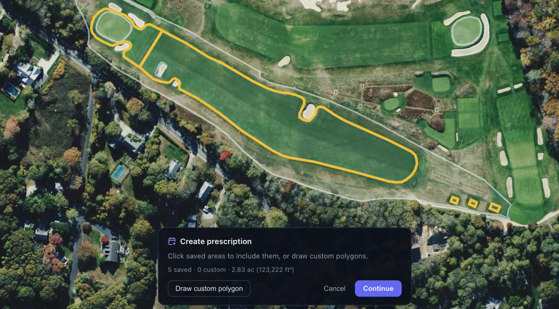
Build a spray plan from your mapped areas, or draw a one-off polygon, then export a sprayer-ready shapefile. It is prescription mapping without paying a consultant to produce the file.
If the sprayed boundary sits a few feet off the map in the field, a built-in calibration offset corrects every future export.
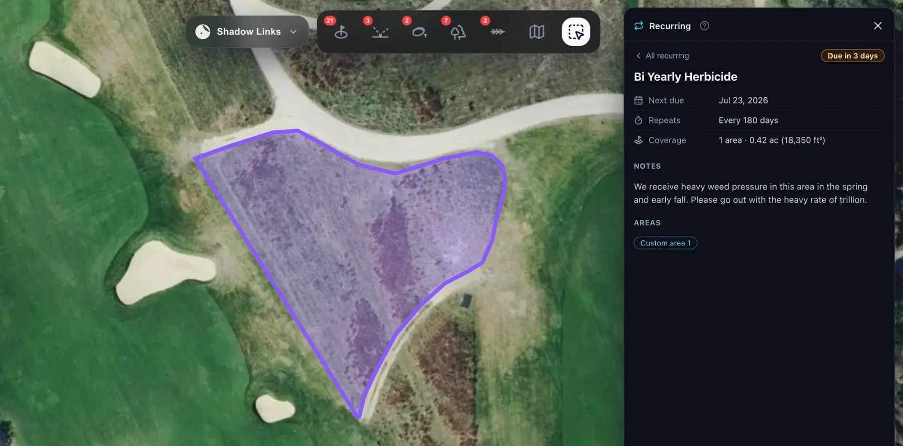
Work that repeats itself.
Put any area on a repeating schedule and recurring applications come due on their own. You are not depending on somebody remembering the interval.
Area Manager is available on the web app.
Common questions, clear answers.
Where do the square footage numbers come from?
Straight from the mapped boundary. Draw each area against high-resolution imagery, or click once and let Turfile Vision trace the visible edge of the surface, then adjust any boundary by hand. The ledger totals it all by hole and by area type.
What sprayers can use the export?
Any GPS sprayer that reads shapefiles, which is the standard format sprayer displays and their desktop software expect. Turfile exports a sprayer-ready shapefile ZIP you transfer straight to the display.
Can we schedule recurring applications?
Yes. Put any area on a repeating schedule and the work comes due on its own. The Area Manager guide covers everything from mapping your first area through sprayer export and recurring maintenance.
Can Turfile map more than playing surfaces?
Yes. The same map carries your irrigation system, drainage, tree inventory, and bunkers, each with its own records and inspections.
Map today for a clear future.
Pick a plan, invite your team, and start mapping right away.