
Drainage mapping for golf courses.
Know where the water goes. Every catch basin, drain line, and outfall on a live map, with its full history attached.
Build the record your course never had.
Most courses have no drainage records at all. Golf course drainage goes in over decades, under different superintendents, different crews, different contractors, and nobody writes it down. Hiring a company to locate and map it costs a fortune.
With Turfile your own crew can build the drainage system map themselves, at a fraction of the cost of a single locate visit. Map the parts you can see, trace the runs you know, and add to the record whenever a repair opens the ground.
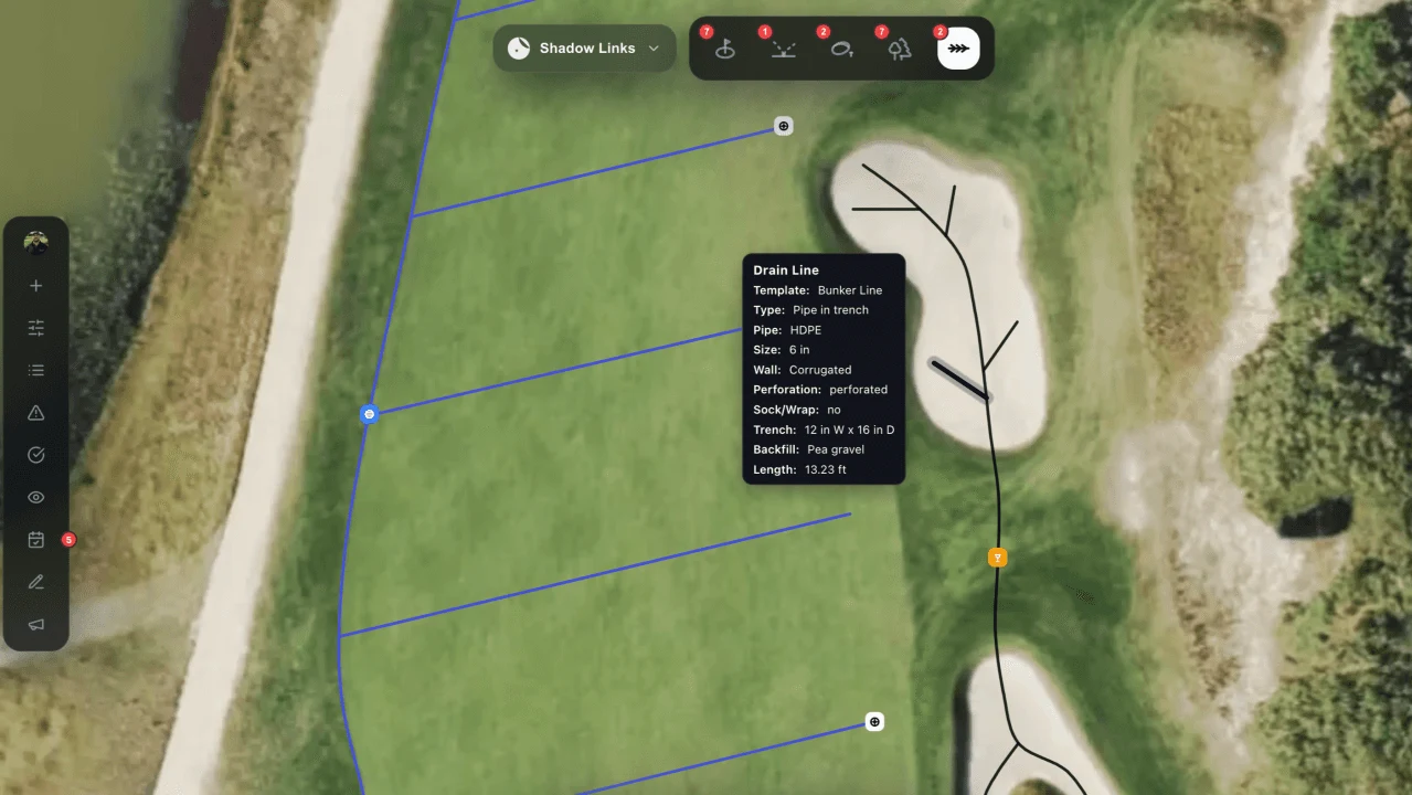
Trace a line by walking it.
Walk a drain line and trace it on the map as you go. Mark catch basins, outfalls, and cleanouts where they actually sit, with pipe details, photos, and notes on each one. It is drainage mapping with the phone already in your pocket.
Storm days are the best time to map, because surface water shows you where the system runs and where it has failed. Our field guide on how to map your drainage system covers the process step by step.
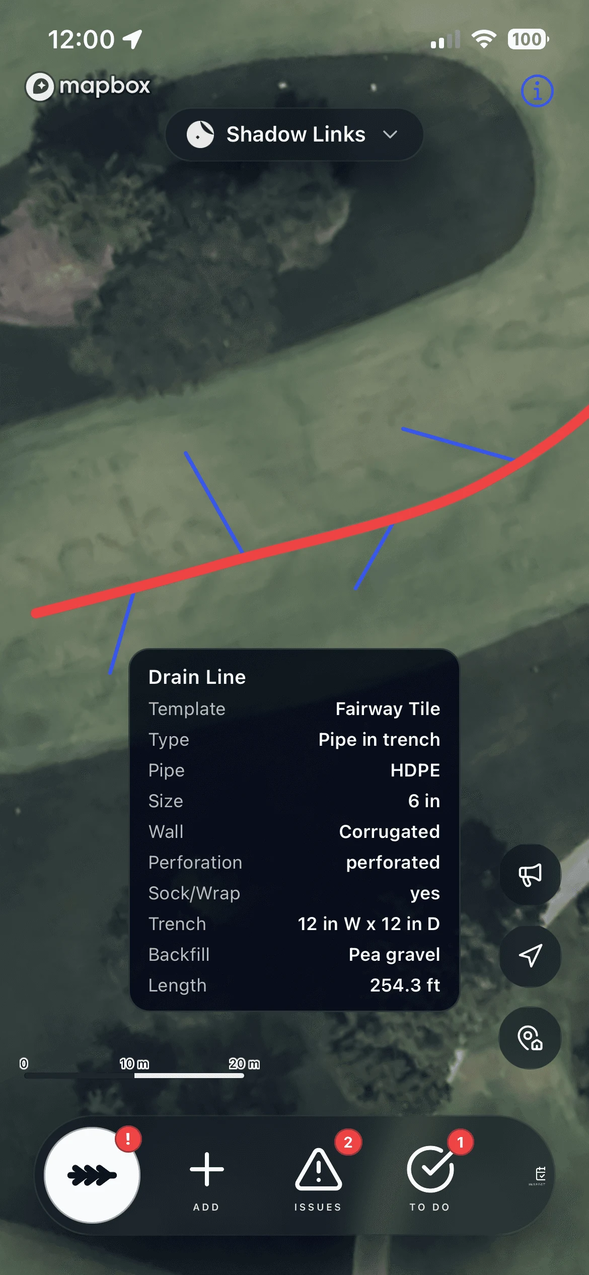
From no records to a complete drainage map.
The old way
- Nothing written down at all
- One veteran who remembers where the lines run
- Dig to rediscover what a past crew already found
- Repairs made, never recorded
 With Turfile
- Affordable, self-serve drainage mapping software
- Every basin, line, and outfall on one live map
- Anyone on the crew can update it
- Every flush, repair, and inspection logged on the asset
Import them in minutes.
Import your GIS files straight into Turfile: shapefiles, GeoPackages, KML, KMZ, and GeoJSON come in as a whole system at once.
Only have old drainage plans on paper or PDF? We will georeference them and upload them as layers, so you can trace the real system over the original drawing. And the map comes back out whenever you need it: GIS-ready shapefiles for QGIS and ArcGIS, or a print-ready PDF sheet for the contractor.
A record that outlasts the crew.
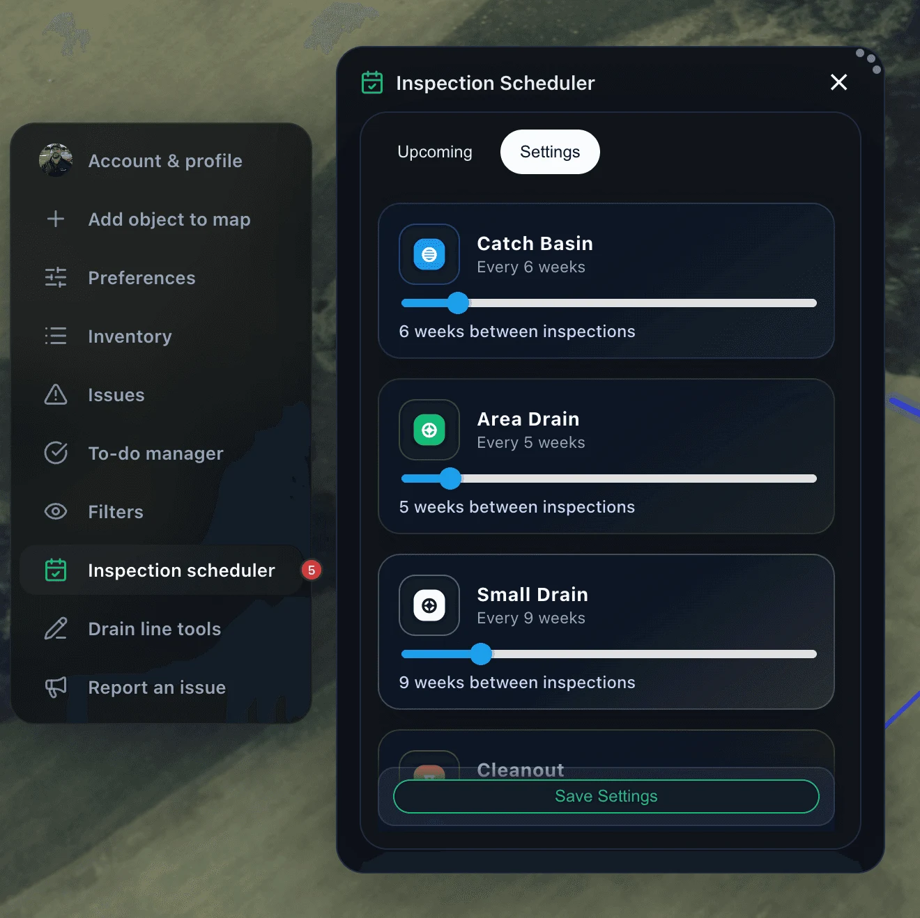
Log flushes, repairs, and inspections on the asset itself. Season over season, that becomes the drainage record plan for every line and basin: what was done, when, and what to watch. Historical as-builts sit alongside the live map as layers, so the old knowledge stays in view.
Seasonal wet areas get logged with dates and photos, so the pattern is documented for whoever manages the course next.
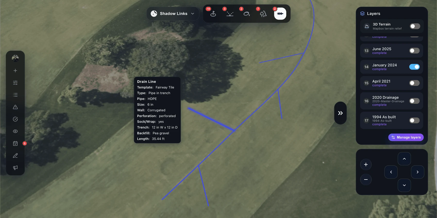
Every type on its own interval.
Set how often each kind of drainage asset should be checked. Catch basins every six weeks, area drains every five, cleanouts on their own cycle. One interval per type, measured in weeks.
Turfile counts forward from the last logged inspection and sorts the list by what needs attention first: never checked, days overdue, then due within the week. Your crew logs each inspection on the asset as it is done.
Common questions, clear answers.
How do we map drainage we cannot see?
Start from what surfaces. Catch basins, outfalls, and cleanouts are visible and give you the endpoints, and known runs get traced between them. Storm days help, because water shows you where the system is working and where it is not. Our guide on mapping your drainage system covers the process step by step.
Can we import existing drainage plans or GIS files?
Yes. Import shapefiles, GeoPackage, KML, KMZ, or GeoJSON directly, a whole system at once. If your plans are scanned or PDF drawings, we will georeference them and upload them as layers so you can trace the live system right over them.
Can we get our map back out of Turfile?
Yes. Export produces GIS-ready shapefiles for QGIS and ArcGIS, styled layers plus an all-in-one GeoPackage, or a print-ready PDF map sheet framed to the exact area you want.
Does Turfile map irrigation too?
Yes. Irrigation gets the same treatment: heads, valves, pipe and wire runs, each with its own service history and inspection schedule. See irrigation mapping.
Map today for a clear future.
Pick a plan, invite your team, and start mapping right away.