

Managing a property involves a constant flow of observations. Some are urgent, others are small but still important, and many need to be tracked and followed up on later. It might be a bunker face starting to wash, a head sitting low, or a tree limb that needs attention.
These observations are a core part of daily course management and often mark the difference between staying ahead of issues and reacting to them later. The challenge is usually not identifying what needs attention, but making sure those observations are captured and turned into organized work.
On a busy property, notes and observations can end up in many different places. A photo might be shared in a group chat, a comment mentioned over the radio, or a reminder discussed in passing and left for later. Each of these works in the moment, but as the number of items grow, they become harder to manage. The question becomes less about what needs to be done, and more about where that work actually lives.
Most teams already communicate effectively using radios, texts, and notes. The issue is not communication, but structure. Course work is inherently location-based. Every task depends on knowing where it is, what needs to be done, and whether it has been completed. When that information is spread across different tools, small gaps start to appear. A photo may show the issue but not the exact location. A message may reference a location but lack detail. A note may capture the task but miss important context.
Individually, these gaps are minor, but over the course of a day they create friction. Time is spent clarifying locations, revisiting conversations, and confirming whether work has been completed. On a golf course, location is not just additional context; it is part of the work itself.
Turfile was built around this idea: course work should be managed spatially. Instead of relying on disconnected notes, teams can create issues directly on the property map. Each issue is tied to a specific location, with notes and photos attached, so the full context of the task lives in one place and is visible to the team.
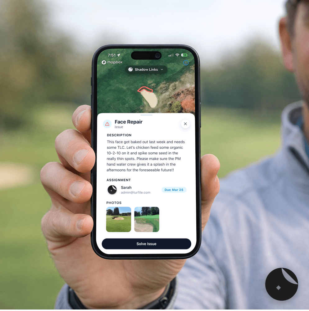
In practice, this is straightforward. A team member can open the map, select the area that needs attention, and add an issue. Notes and photos provide clarity on what was observed and what needs to be done.
Once created, the issue remains active on the map until it is completed. When the work is done, the update stays tied to that location, creating a clear and simple record without the need to search through past messages or rely on memory.
This approach helps turn day-to-day observations into a more structured workflow. Instead of finishing a course tour with scattered notes, teams build a clear view of active work across the property as they go. This supports better planning, clearer communication, and more efficient execution.
Next time you are driving the course in the afternoon, taking notes, sending photos, or building a mental list of everything that needs to be followed up on, ask yourself one question:
Is there a better place for this work to live?